The Surveyor's Grid That Carved Up a Continent
The Debt That Drew Lines Across America
Look down at any American city from an airplane window, and you'll see it immediately: the relentless grid of streets cutting the landscape into perfect squares. It's so familiar that most Americans never question why their cities look like giant graph paper, while European cities twist and curve along ancient paths. The answer traces back to a room full of arguing congressmen in 1785, a mountain of Revolutionary War debt, and one surveyor's desperate attempt to make everyone happy.
Thomas Jefferson never intended to redesign American civilization. He just needed to sell land—fast.
 Photo: Thomas Jefferson, via images.deepai.org
When Debt Demanded Geometry
By 1785, the new United States was drowning in debt. The Revolutionary War had cost a fortune, and the government was essentially broke. The solution seemed obvious: sell the vast western territories to raise cash. But first, someone had to figure out how to divide up millions of acres of unmarked wilderness.
Congress was deadlocked. Southern representatives wanted large plantations carved from the territory. Northerners preferred small family farms. New England delegates insisted on preserving their traditional township system. Nobody could agree on anything except that they desperately needed the money.
Jefferson, serving as chairman of the land committee, proposed a compromise so simple it seemed almost boring: divide everything into perfect squares. Six-mile-square townships, subdivided into one-mile-square sections, further divided into quarter-sections of 160 acres each. Clean, mathematical, and completely indifferent to the actual landscape.
The Ordinance That Changed Everything
The Land Ordinance of 1785 passed without much fanfare. Most congressmen saw it as a temporary administrative solution—a way to quickly survey and sell land to pay off debts. Nobody realized they had just imposed a geometric straightjacket on an entire continent.
The ordinance required surveyors to march across the wilderness with chains and compasses, marking off perfect squares regardless of rivers, hills, or existing Native American trails. Starting from a point on the Pennsylvania-Ohio border, they began drawing lines that would eventually stretch to the Pacific Ocean.
 Photo: Pacific Ocean, via besthotelshome.com
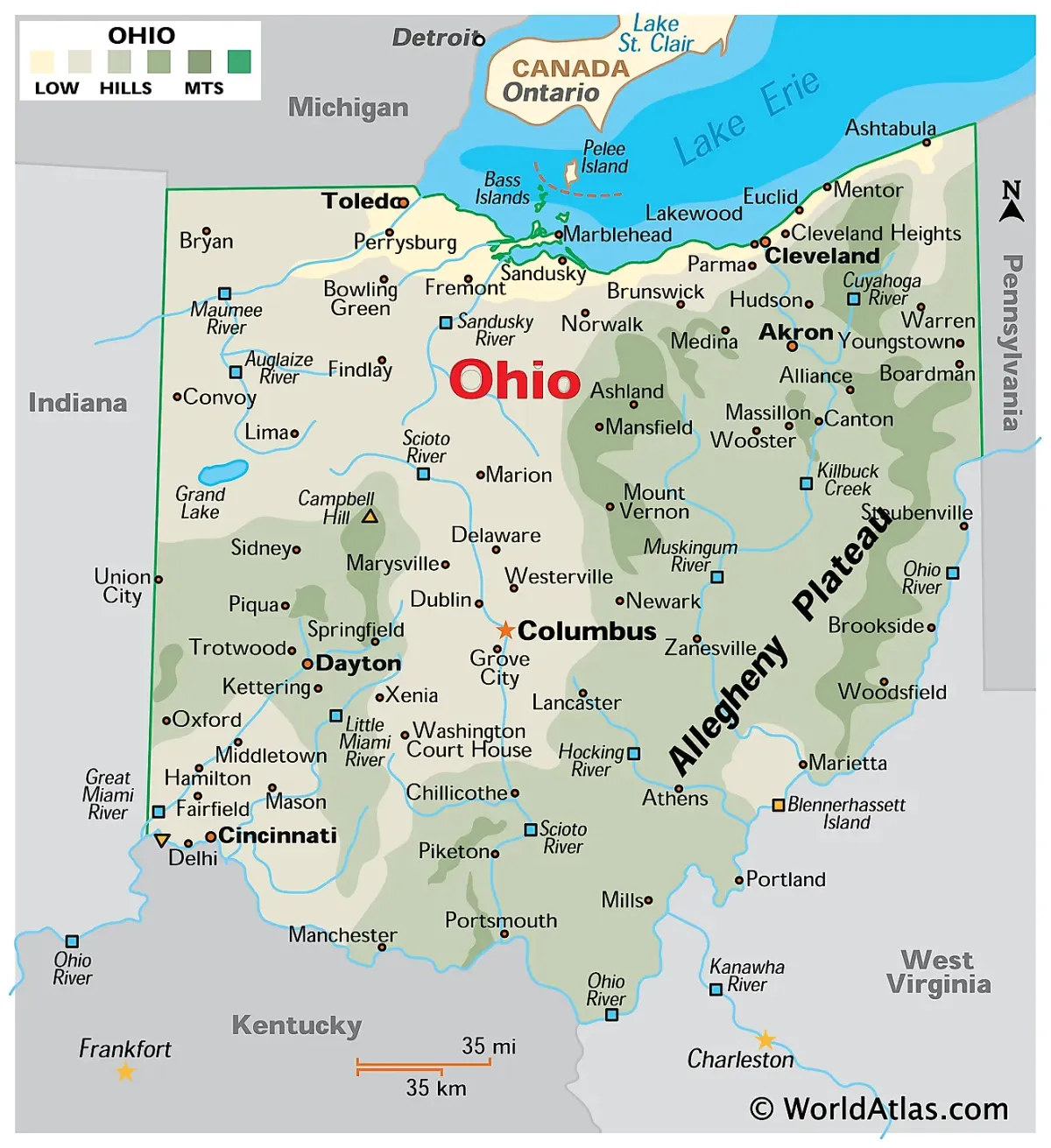 Photo: Pennsylvania-Ohio border, via mapofohio.net
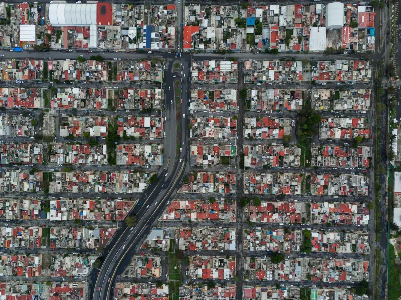
How Math Became Main Street
As settlers poured into these pre-surveyed squares, something unexpected happened. The abstract grid on surveyors' maps became the foundation for actual towns and cities. Property lines followed the survey lines. Roads ran along section boundaries. Town squares occupied the center of townships, exactly as Jefferson had sketched.
The system was brutally efficient for real estate speculation. Land could be bought and sold like commodities, described simply by section numbers and township coordinates. No need for lengthy descriptions of natural landmarks or complex surveys. A buyer in Boston could purchase property in Ohio sight unseen, confident that "Section 16, Township 3" meant exactly 640 acres in a perfect square.
The Invisible Architecture of American Life
That geometric efficiency had profound consequences nobody anticipated. The grid system made westward expansion faster and cheaper, encouraging the rapid settlement of the frontier. It standardized property ownership in ways that made mortgages, insurance, and real estate development predictable nationwide.
But it also created a distinctly American relationship with land. Unlike European cities that grew organically around markets, churches, and natural features, American cities were products of mathematical planning. Streets ran in straight lines not because it made practical sense, but because surveyors had drawn them that way decades earlier.
The grid even shaped American social patterns. The regular spacing of sections created the standard distance between rural communities—about six miles, or a comfortable day's walk to the township center. This rhythm of settlement, repeated across the continent, became part of the fundamental structure of American rural life.
From Survey Stakes to Suburbs
By the 20th century, Jefferson's grid had evolved into something he never could have imagined. Suburban developers used the same square-mile sections to create residential neighborhoods. Shopping centers anchored the intersections where section lines met major roads. Even the modern suburb's characteristic cul-de-sacs and curved streets were laid out within the boundaries of those original surveyor's squares.
The grid system also made possible the uniquely American phenomenon of numbered streets and avenues. In cities built on the survey grid, addresses could be logical and predictable. "1200 West" meant exactly 12 blocks west of the baseline. This mathematical precision made American cities navigable in ways that European cities, with their maze of named streets, never could be.
The Geometry We Can't Escape
Today, driving across America means traveling along section lines that Thomas Jefferson drew on a map in 1785. The mile-square grid is visible everywhere: in the spacing of rural roads, the layout of city blocks, the boundaries of school districts, and the shape of farm fields. Even Google Maps reflects this 240-year-old surveyor's compromise.
What began as a quick fix for Revolutionary War debt became the invisible skeleton of American geography. Jefferson's grid didn't just divide the land—it created a uniquely American way of thinking about space, property, and community. Every time you give someone directions using numbered streets, every time you see a perfectly rectangular city block, you're experiencing the lasting power of one surveyor's solution to a long-forgotten congressional argument.
The next time you fly over America's geometric landscape, remember: you're looking at the physical manifestation of political compromise, transformed into the blueprint for a nation.